An urgent weather warning has been issued for three West Coast states after a bomb cyclone is expected to unleash hurricane conditions in the region.
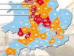
The National Weather Service (NWS) alerted residents in northern California, Oregon and Washington to potential hurricane-force winds, catastrophic flooding and feet of high-elevation snowfall this week.
Meteorologist Ryan Maue said that the central pressure of this bomb cyclone will fall almost 70 millibars in 24 hours, reaching pressure levels similar to that of a Category 4 hurricane.
This super-charged storm will bring wind gusts of up to 70 miles per hour, and pull a Category 5 atmospheric river onto land that will dump up to 20 inches of rain in certain areas.
An atmospheric river is a long and narrow region of the atmosphere that carries warmth and moisture from the tropics toward Earth's poles. A Category 5 is exceptionally hazardous, bringing intense storm impacts to land.
Storm impacts are expected to begin Tuesday afternoon and persist through the week, possibly stretching into the weekend.
Americans living in these areas are advised to find shelter in an interior room on the lowest floor of a sturdy building and avoid cars and mobile homes.


The NWS predicted that northern California and Southwest Oregon will see the highest rainfall totals, potentially resulting in flooding, rockslides and mudslides.
As these storm systems move toward the West Coast, Washington, Oregon and California can expect at least six inches of rain, with over 20 inches possible in the mountains.
The stream of moisture funneling into the mountains could also drop feet of snow from the higher elevations of the Cascades southward into the Siskiyou Mountains of Northern California. This may impact travel in some passes.
High winds should kick up on Tuesday and persist into early Wednesday, with coastal parts of Northern California, Oregon and Washington potentially weathering gusts over 60 or 70 mph. Power outages and downed trees are expected.
Bomb cyclones form when a midlatitude storm rapidly intensifies over a 24 hour period.
Intensification essentially means a drop in pressure, and storms need to drop at least 24 millibars within a 24-hour period to be considered a bomb cyclone.
It is rare for a storm to lose 70 millibars of pressure this quickly.
By comparison, Hurricane Milton - which rapidly strengthened from a Category 1 hurricane to a Category 5 - lost 84 millibars of pressure in 24 hours.


Maue added that the the 'mega' bomb cyclone and 'climate fueled' atmospheric river will dump eight trillion gallons of precipitation on California, five trillion on Oregon, three trillion on Washington and 2.5 trillion on Idaho - totaling almost 20 trillion gallons across these four states.
Areas affected by burn scars, or charred, barren patches of land left behind by wildfire, will be especially prone to flooding.
That is because burned soil can be as water-repellant as pavement, according to the National Oceanic and Atmospheric Administration (NOAA).
Mudslides and rockslides are also more likely in areas recently impacted by wildfire, as the loss of trees, vegetation and their roots leaves soils unstable and easily-erodible.
By Tuesday afternoon, meteorologists predict that heavy precipitation and strong winds will move into the West Coast as the bomb cyclone and atmospheric river approach shore, Washington Post forecaster Ian Livingston reported.
Current forecasts place the focus of storm conditions from Vancouver Island in Canada to around the Oregon-California border on Tuesday night.
'Heading into Wednesday, the atmospheric river will probably shift its focus slowly southward from southern Oregon into Northern California,' Livingston reported.
Toward the end of the week and into the weekend, rain and high-elevation snow could shift toward central or Southern California, he added.
Extreme storm systems like this bomb cyclone are likely being fueled by human-driven climate change in a number of ways, according to the Union of Concerned Scientists.
For one, rising ocean temperatures create a greater contrast between over-land temperatures and the temperature of Arctic air moving south. Storms feed off of this ever-widening difference.
Additionally, increasing evaporation from land driven by rising global temperatures pumps the atmosphere full of water vapor. When that vapor condenses into clouds, it releases latent heat, which storms use for fuel.
Increased water vapor also provides more moisture for storms, resulting in more frequent heavy precipitation events.
Climate change is also increasing the number of days that the western US will experience atmospheric rivers, according to the US Department of Agriculture.
And as warming air and ocean temperatures provide more fuel for atmospheric rivers to become larger and stronger, they will become more hazardous as well.


